Why stop
Havelock is the corridor’s western basecamp for the wild country to the north: the Kawartha Highlands — Ontario’s largest provincial park south of Algonquin, all paddle-in lakes and Shield granite — and Petroglyphs Provincial Park, home to the largest known concentration of Indigenous rock carvings in Canada. The Petroglyphs are about 40 minutes north and genuinely moving; if you make one cultural stop on the whole corridor, make it that one.
The trail west
The east-west rail trail that parallels Highway 7 — the old CP corridor, part of the Trans Canada Trail — reaches Havelock from Tweed and Kaladar, making the village the western anchor of the corridor’s trail system and a natural fuel-and-food stop for long-haul ATV and snowmobile runs.
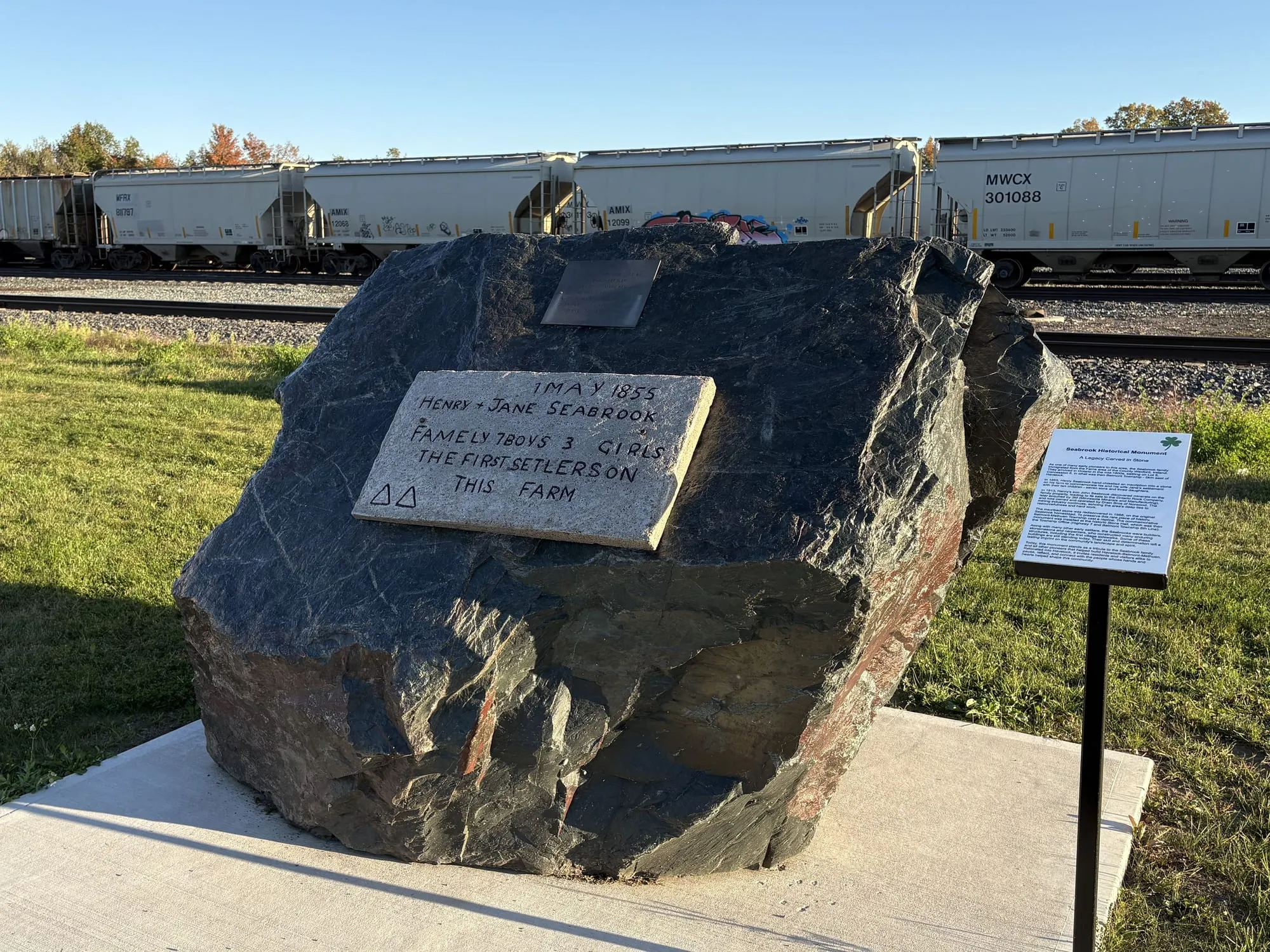
Beside the tracks on Ottawa Street West, next to the caboose, stands the Seabrook Historical Monument. Its inscription is dated 1 May 1855 and marks Henry and Jane Seabrook, “the first setlers on this farm,” with their seven boys and three girls. The spelling is theirs.
The Jamboree legacy
For over thirty years, one August weekend made Havelock one of the biggest country music towns in Canada: the Havelock Country Jamboree drew tens of thousands of campers and headliners from Nashville on down. The festival wound down for good after 2023, and the village still wears the legacy proudly — you’ll meet people at the diner counter who can tell you exactly where they camped in ‘98. If a successor event ever rises on those grounds, this page will be the first to say so.
Run a business in Havelock? Claim your free listing.